
ALTA Survey for Commercial Sites With Railroad Frontage
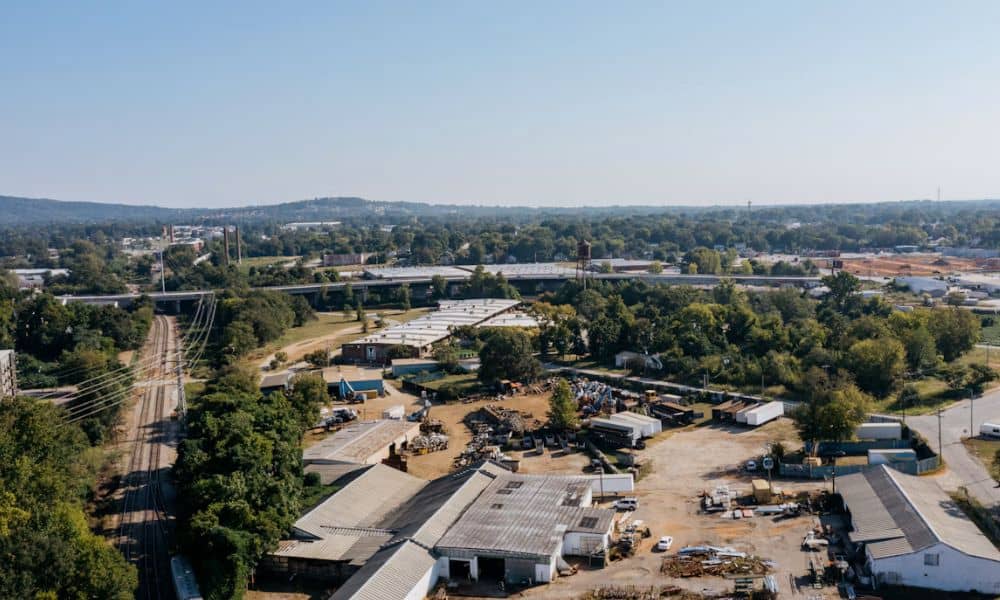
A commercial lot beside a railroad can look like a strong fit for a warehouse, plant or truck yard. The rail line next door also brings questions that most sites never raise. Buyers, lenders and developers need to know where the parcel ends, whether any rail use crosses it and what the records say about both.
An ALTA survey gives the deal team a shared starting point. It maps the boundary, the improvements and the recorded matters a surveyor can plot, and it shows what the crew found on the ground. That map won’t settle every legal question about a railroad. It does show you which questions need answers before closing or design moves ahead.
Start With the Property Line Along the Rail Corridor
The first job is finding where the parcel’s boundary sits in relation to the railroad’s land. That line comes from deeds, plats, past surveys and monuments the surveyor finds in the field. The tracks themselves don’t mark it.
Railroads often hold corridors much wider than the rails. A line may run near the middle of its strip, close to one side or well off center. The ballast, ditches, signal poles and old fences on site may fall inside the corridor, on your parcel or right across the line. An old fence might follow a convenient path instead of the deeded line.
So a buyer shouldn’t read the edge of the gravel as the edge of the lot. The surveyor compares the record description of the parcel with the record description of the corridor and with the evidence in the field. Gaps or overlaps between those records can show up here, and they carry more weight on a rail-side parcel than almost anywhere else. A strip of a few feet can decide whether a dock, truck lane or building wall fits.
Separate Rail Access From Simple Railroad Frontage
Railroad frontage means the parcel touches railroad land. Rail access means the owner holds a right to use the line, often through a spur, siding or crossing. Sharing a border with a railroad gives the owner no right to load cars, cross the tracks or connect to the line.
Many older industrial sites still have a spur track, a switch, a gated crossing or a loading platform that once served rail cars. The 2026 ALTA/NSPS standards address observed railroads, sidings and spurs in their fieldwork requirements. These features can end up on the drawing when they apply to the site, which gives the team a clear record of what physically exists and where it sits.
A drawn spur still proves nothing about who may use it. The right to run cars onto a siding usually comes from a track agreement or other document with the railroad. That agreement may have ended, changed hands or never covered the current owner. The survey shows where the track sits, and the documents show whether anyone may use it.
The reverse case matters too. A spur that crosses your parcel to reach a neighbor may point to a use by others that the title work should explain. The survey flags that physical condition so the title team can look for the matching right.
Reconcile Railroad Documents With Current Site Evidence
Records and field evidence need to be read side by side. Under the 2026 standards, an ALTA survey addresses plottable rights-of-way and easements disclosed in the documents supplied for the job. Plottable means the document describes a location the surveyor can draw.
Rail-side parcels often carry a long paper trail. Old railroad deeds, right-of-way grants, crossing agreements, utility easements along the corridor and recorded plats may all touch the site. Some describe a strip by its distance from the track centerline. That only works if the surveyor can tie it to where the centerline sat when someone wrote the document, since tracks can shift over decades of repairs.
When the records and the ground disagree, the drawing and notes should show it. A crossing with no matching document, a fence well off the deeded line or a spur that runs outside its described strip all deserve a closer look. The surveyor reports what the evidence shows. Attorneys and title professionals decide what it means for ownership and insurance.
Send the full title commitment and copies of the exception documents before fieldwork starts. Missing papers can leave a rail-related right off the drawing. The surveyor can only plot what the documents in hand describe.
Check How Rail Adjacency Affects the Development Plan
Once the boundary and rail features sit on one map, architects and engineers can test the plan against real conditions. Chicago gives this step extra weight. Six of the seven Class I railroads operate in the region, and about a quarter of the nation’s freight rail traffic moves through the Chicago area. Plenty of commercial and industrial parcels in and around the city share a line with an active corridor.
The surveyed edge sets where a building can sit, where trucks can turn and where docks can face. A plan drawn to the edge of the ballast might push a wall or truck lane onto railroad land. A team that hopes to reuse a spur should confirm its location and its rights before designing around it.
Access deserves the same care. A gated crossing that trucks use today may rest on a permit the railroad can end instead of a recorded right. If the plan depends on that crossing, the team needs to know before it commits to a layout. Setbacks or clear areas near tracks can also apply, and those rules depend on the railroad, the municipality and the project.
A topographic survey added to the ALTA work can help too. Rail beds often sit higher or lower than the land around them, and corridor ditches can affect grading and drainage. Ask your surveyor whether the project needs that extra detail.
Resolve Rail-Side Questions Before Closing or Design
The best time to raise rail questions is while there’s still room to answer them. Buyers, developers, lenders, title professionals, surveyors and design teams should list open items early. Some will need more documents, and others may need contact with the railroad or more field work.
Questions worth settling before the deal or design moves forward:
- Does the surveyed boundary match the corridor description in the railroad’s records?
- Do any tracks, ballast, fences or ditches cross the boundary in either direction?
- Does a recorded document give the owner a right to use the spur, siding or crossing?
- Does any rail feature on the site show use by others that the title work should explain?
- Would extra Table A items or other negotiated work help answer the open questions?
An ALTA survey supplies the evidence. It doesn’t decide who owns a disputed strip or who may run cars on a spur. Those answers come from the documents, the title company and legal counsel, so give them enough lead time before closing or before plans are final.
Frequently Asked Questions
Does an ALTA survey show railroad tracks next to a commercial property?
It depends on the site and the scope of the job. The 2026 ALTA/NSPS standards address observed railroads, sidings and spurs, particularly where they suggest someone else uses or crosses the property. Talk with your surveyor about how nearby tracks will appear on your drawing.
Can railroad tracks be located outside the railroad’s property boundary?
They can. Track position and property lines are two separate questions, and rails can move during rebuilding over the years. A survey compares where the tracks sit today with the record boundaries so you can see where each one falls.
Should an old railroad spur be mentioned when ordering the survey?
Yes. Tell the surveyor about any spur, siding or crossing you know of, even one that looks abandoned. That detail helps set the scope and points the research toward the right documents.
