
ALTA Surveys for Large-Scale Development Sites
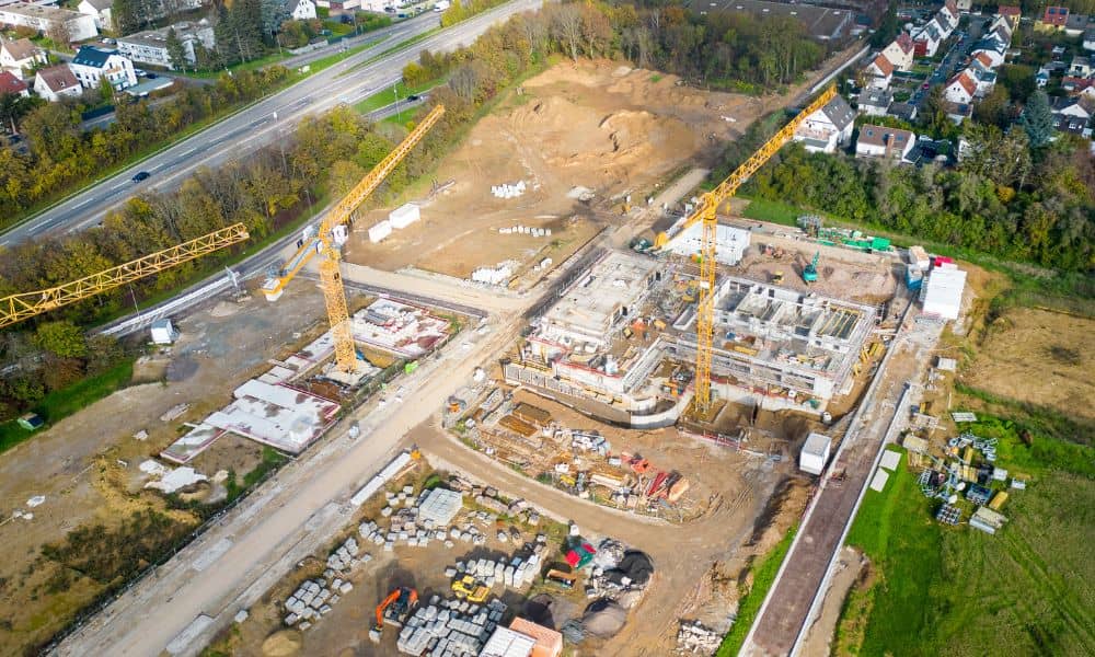
On a large development site, the survey plan often falls behind the project. When a tract covers thousands of acres, the ALTA survey has to answer questions about boundaries, access, easements and existing features across ground that can take crews weeks to cover. Starbase Louisiana shows how big these sites can get. SpaceX and Governor Jeff Landry announced the $100 billion project on August 25, 2026, for about 125,000 acres in Vermilion Parish. Few projects will come close to that size, but the lesson holds for any big tract. Settle what the survey covers and how the results will arrive before crews start, and the data will stay useful from due diligence through design.
Define the Survey Limits Before the Site Plan Expands
The survey limits are the exact parcels and edges the ALTA survey will cover. Put them in writing before fieldwork begins. On big projects, the land under contract tends to change as buyers pick up access strips, add parcels or drop outparcels.
A late change costs more than it looks. Crews may need to go back to the field, and the title commitment has to describe the added land before the surveyor can show its recorded matters. If a parcel might join the project later, tell the surveyor now. Research and control can then reach that ground without a second start.
Compare the limits with the title company as well. The survey and the commitment should describe the same land in the same pieces. A mismatch between the two tends to surface near closing, which is the worst time to find it.
Match Field Coverage to the Decisions the Survey Must Support
Field coverage should follow the decisions your team has to make. Every acre doesn’t need the same detail. Areas near planned buildings, entrances and utility tie-ins usually call for dense data. Remote ground may only need boundary evidence and visible features near the lines.
List the decisions up front. A lender closing, a zoning review, an early site layout and a drainage study each lean on different information. Optional Table A items, such as topography, add work only where you actually need that data.
Wet ground changes how crews work. Much of coastal Louisiana is marsh, and crews can’t simply walk or drive to every point. Aerial mapping can capture terrain and features over those areas. Boundary evidence still needs a surveyor on the ground, and the licensed surveyor is the person who certifies the final survey.
Reconcile Long-Distance Boundaries Before Design Depends on Them
On a large tract, one boundary line can run for miles and cross several old deeds. A small gap between a record description and a found monument grows over that kind of distance. Your surveyor has to settle those differences before engineers place roads, drainage or setbacks against the lines.
Louisiana records add their own layers. Much of the state uses the township and range system, but some areas trace back to French and Spanish land claims. Those claims often appear as long, narrow lots measured in arpents along waterways. Under the 2026 standards, the surveyor gathers adjoining deeds as part of the research, and that helps reveal gaps and overlaps along shared lines.
Water adds another question. SpaceX reports shoreline loss in Vermilion Parish of 3.3 to 23 feet per year. Where a boundary follows water or a moving shoreline, the survey can show what exists on the ground today. It can’t settle who owns land the water has claimed. Bring your title company and an attorney in early on those edges.
Plan Survey Control for Teams Working Across a Large Site
Survey control is a network of fixed points with known positions and elevations. Every crew measures from it. On a big site, you may have boundary crews, drone operators, engineers and contractors working in different corners during the same month.
Ask your surveyor where control points will go and how far apart they’ll sit. Each work area should have points close enough to use. The points need protection from equipment, and the team needs one shared list of coordinates. Tying the network to state plane coordinates and a national vertical datum lets later work fit with the ALTA data.
Elevation needs special care in coastal. Parts of the region are sinking, so an older benchmark may no longer match its published height. Ask how the surveyor will check vertical control before design and construction staking rely on it.
Set Deliverable Detail Before Large-Site Data Becomes Unmanageable
A survey of thousands of acres produces a huge amount of data. If nobody agrees on the format early, the finished product can be hard to read and harder to use. Settle these points before fieldwork:
- Sheet count, drawing scale and a key map that shows how the sheets fit together
- Digital file types and the coordinate system for CAD files
- How Schedule B exceptions will be labeled and cross-referenced
- Whether topography and aerial data arrive as separate files
- Who receives certified copies and on what date
An interim boundary review can help. It gives your team a look at the major boundary findings before the full drawing is done. You can spot a problem while there’s still time to act on it.
Plan for revisions too. Title commitments often update during due diligence, and each update can change what the survey must show. Agree on how those changes will be handled and priced.
