
ALTA Surveys for Waterfront Commercial Properties
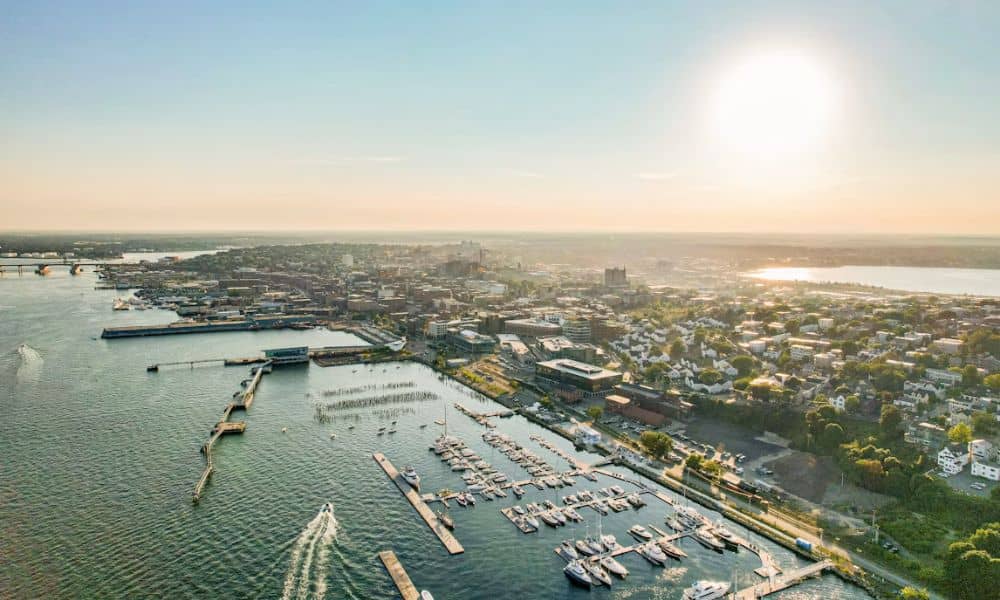
Commercial property on Portland’s waterfront rarely ends at a clean line on dry land. Much of the ground along Commercial Street was once part of Casco Bay and the Fore River, and the piers beyond it reach out over water the state controls. An ALTA survey for one of these sites has to show all of those pieces in a form that a buyer, lender and title company can use.
Developers and investors watch this stretch of shoreline closely. The city has spent years weighing how much room its working waterfront should give to non-marine uses, and public facilities like the International Marine Terminal and the Maine State Pier anchor a busy port. If you plan to buy or redevelop a waterfront commercial parcel here, settle the survey scope before the deal terms lock in.
Identify Where the Commercial Parcel Meets the Waterfront
The first task on any waterfront ALTA survey is to find where private ownership ends and public ownership begins. Maine handles this differently than most states. Under the Colonial Ordinance of 1641-1647, which Maine courts treat as part of state common law, a coastal owner’s title can run past the high-water mark down to the low-water mark.
That reach has limits. If the low-water mark lies far out, private ownership stops 100 rods, or 1,650 feet, seaward of the high-water mark. The public also keeps its rights to fish, fowl and navigate across that privately owned strip.
Portland adds another layer because so much of its shoreline is filled ground. Maine law gives intertidal and submerged land filled before October 1, 1975, its own treatment, so the date and extent of any fill can matter. Your surveyor can show where the fill sits compared with the natural shoreline described in older deeds and plans. Your title attorney then decides what those lines mean for ownership.
Account for Wharves, Piers, and Other Waterfront Improvements
An ALTA survey treats wharves and piers as improvements, the same way it treats buildings and parking lots. The surveyor locates each structure and shows how it sits in relation to the parcel lines, the low-water line and any leased area. On a Portland pier, a single structure can cross upland, filled land and open water.
The land under a pier deserves as much attention as the pier itself. Maine’s Bureau of Parks and Lands explains that a pier on submerged land may be privately owned while the land and water beneath it are not. Permanent structures on or over those public submerged lands need a lease or easement from the Bureau.
Older wharves need a closer look. Structures built before October 1, 1975, received constructive easements, and those easements expired on September 30, 2005. Ask the seller for any current submerged lands lease and pass it to your surveyor so the drawing can show the lease area beside the actual footprint.
The survey records where floats, fender piles, ramps and pier buildings sit. It doesn’t report on their structural condition. A marine engineer answers that question, and your lender or insurer may ask for that report on its own.
Match the ALTA Survey Scope to Waterfront Development Plans
An ALTA/NSPS survey has a standard core plus a menu of optional items called Table A. The core covers boundaries, visible improvements, easements and other matters the national standards require. Table A items add details your project needs, and the right choices depend on what you plan to build.
For a waterfront development, the useful optional items often include:
- Flood zone classification for any new building near the harbor edge
- Elevations and contours when your design team plans new grades or a raised first floor
- Zoning setback details taken from a zoning report or letter you give the surveyor
- Observed utility evidence such as manholes, valves and outfalls
- Building dimensions for structures you plan to keep or replace
Share your concept plan with the surveyor before you sign the proposal. A buyer who plans to keep an existing marine business running may need a lean scope. A developer who wants to add a building on a pier or raise the site needs far more detail about elevations and utilities.
Also list every party who needs to appear in the survey certification. That list usually includes the buyer, the lender and the title insurer. A party added late can mean a revised drawing and a delay.
Check Waterfront Restrictions Before Finalizing Survey Requirements
Portland’s waterfront rules shape what you can build, so they should shape the survey too. The city’s land use code includes waterfront zones, a shoreland zone and flood plain rules. The Waterfront Central Zone along Commercial Street has limited non-marine uses since a 1987 referendum, and the city has continued to revisit those limits. Confirm the current rules with the planning office before you finalize the scope.
These rules affect survey needs in practical ways. A setback measured from the high-water line only works if the survey shows that line. A flood elevation standard only helps if the survey ties the site to the correct vertical datum.
State agencies may also have a say. Work in or next to coastal wetlands can require a permit from the Maine Department of Environmental Protection, and new pier space over submerged land brings the Bureau of Parks and Lands back into the process. Your surveyor doesn’t issue these approvals, but a survey that shows the right lines gives each application a solid base.
Resolve Waterfront Survey Questions Before the Deal Advances
Waterfront surveys raise questions that take time to answer. A deed may call for “the shore” or “the harbor” without naming a water line. An old plan may show a pier that someone later extended or rebuilt, and a lease area may not match the structure that stands there today.
Bring these gaps to the table early. Your surveyor can flag where the records and the ground disagree. Your title attorney can decide what each conflict means for ownership, and the title company can clear an exception, add one or ask for more research.
Order the survey early enough that these answers arrive before your due diligence period ends. Shoreline fieldwork may need to happen at low tide, which can affect the schedule. A contract with extra time for survey review gives you room to renegotiate or extend if a real problem turns up.
