
How an ALTA Survey Supports a Property Subdivision
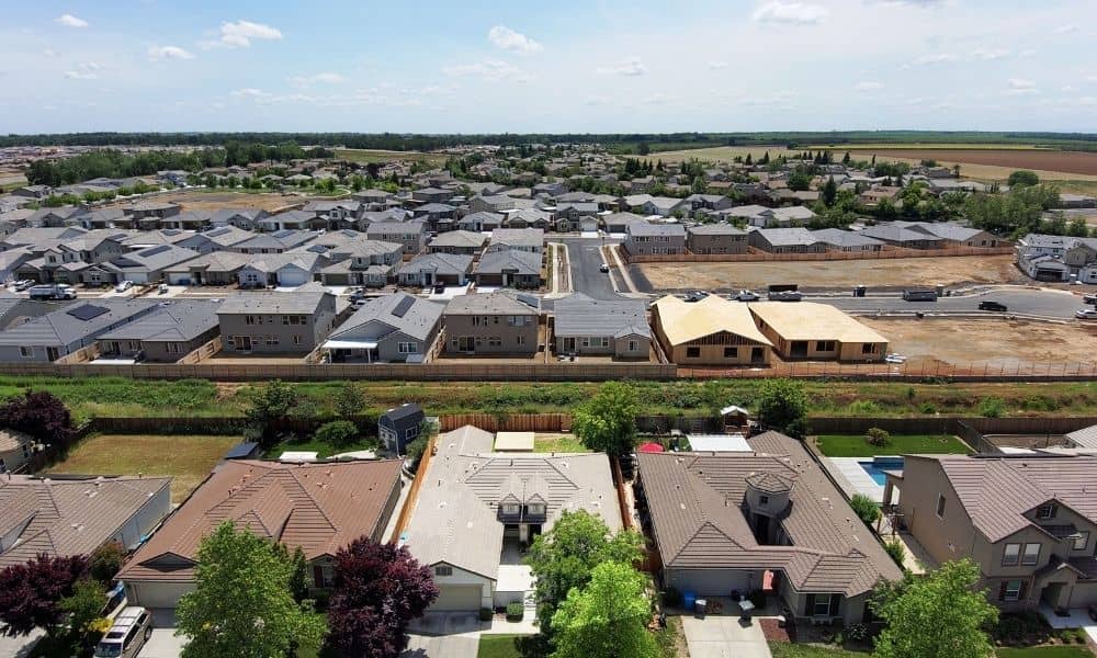
Northwest Arkansas keeps growing fast. Regional planners expect the area to pass one million residents in the coming decades. Growth like that changes how developers divide and build large tracts of land. Owners and developers have to make careful choices early, and good choices start with good information about the site.
An ALTA survey is one source of that information. It gives the project team a detailed record of a property’s current conditions before a subdivision plan takes shape. That record becomes a dependable reference for the land as it stands today.
An ALTA survey can support subdivision planning, but it doesn’t replace the subdivision plat, the engineering work, the zoning review or the local approval steps. It feeds those stages. It doesn’t take their place.
Establishing the Existing Parcel Before It Becomes Several
Before one tract turns into several lots, the team needs a clear picture of what they’re starting with. You can’t lay out new parcels well if the shape and size of the original property are fuzzy. An ALTA survey records the current boundary lines and other measured details, which gives everyone firmer footing.
That starting picture matters because subdivision is a change. You take one legal parcel and propose to split it into a new set of lots. The proposed layout has to connect back to the real, measured property, not a rough sketch or an old deed description.
When the layout changes, the survey information and the future subdivision plat have to line up. The surveyor’s record of the existing parcel gives the plat something accurate to build from. If those two drift apart, problems show up later.
Testing the Proposed Lot Layout Against What Is Already on the Ground
A subdivision concept usually starts on paper. Someone sketches lines to show where future lots might sit. But the paper doesn’t show the barn, the driveway or the paved yard that already sits on the property.
An ALTA survey maps those existing features. It records buildings, paved areas and other improvements already in place. That detail lets planners test a proposed lot layout against real conditions instead of guessing.
Say a draft plan puts a lot line straight through an existing building or across a paved access area. That’s worth catching before the design moves ahead. Spotting a conflict during planning is far easier than reworking lots after the layout is nearly set.
A ground check can also show when an arrangement simply won’t work as drawn. A building’s spot or a paved area’s footprint might mean a lot line needs to shift. Adjusting early keeps the project moving.
Giving Planners a More Reliable Starting Point for Infrastructure Coordination
Dividing land is never just about property lines. New lots need roads, water lines, sewer or septic service, plus drainage. So the lot layout and the utility planning have to move together.
Accurate site information helps the whole team stay in sync. When the surveyor’s record shows existing conditions clearly, the civil engineer and the developer share one basis for planning roads and utility routes across the proposed lots. Guesswork at this stage tends to cause rework later.
This connects directly to how Northwest Arkansas is planning its future. The region’s growth strategy pushes for new development to line up with existing roads and utility service rather than run ahead of them. Local wastewater planning is part of that picture too, since sewer capacity can shape what a site can support.
An ALTA survey does not tell you whether the local system has enough water or sewer capacity for a new subdivision. That answer comes from utility providers, engineering studies and local reviews. The survey gives the team accurate ground information to plan around. It doesn’t measure capacity.
Helping the Development Team Coordinate Survey Information With the Subdivision Plat
A subdivision project pulls together several professionals. The surveyor, the civil engineer and the developer all need to work from the same understanding of the site. When they share one accurate record of existing conditions, their pieces fit together more smoothly.
The ALTA survey can serve as that common reference while the team develops the subdivision layout. It shows what’s really there. The design team can lean on it as they shape lots, plan access and route services.
Even so, the ALTA survey is not the subdivision plat. In Arkansas, a subdivision plat is a boundary survey that creates the new parcels, and it falls under the recording requirements that apply to it. The plat is what makes the new lots real in a legal sense. The ALTA survey supports the work leading up to it.
Requirements also change from place to place. Cities and counties set their own subdivision rules, so a plan that fits one jurisdiction may need changes in another. Checking the local subdivision requirements early saves trouble down the road.
Knowing When an ALTA Survey Is Only One Part of the Subdivision Picture
An ALTA survey can add real value to a subdivision project without being the only thing the project needs. Most subdivisions call for more than one kind of study before approval.
Depending on the property and the local rules, a project might also need:
- Additional surveying or a subdivision plat prepared to local standards
- Civil engineering for roads, grading and utilities
- Drainage or stormwater work
- Soil or environmental studies
- Utility coordination with local providers
Because requirements vary, it helps to pin down the local subdivision ordinance and project needs early. Arkansas rules let local codes, ordinances or contract terms set stricter requirements than the baseline. Knowing that up front keeps a plan realistic.
A surveyor can help sort out what survey information a specific project should include. That guidance is useful when a site’s conditions or a jurisdiction’s rules aren’t clear at the start.
Northwest Arkansas shows why this matters. Growth that stays coordinated with roads and utilities takes more than a few lines on a map. It takes accurate ground information, the right studies and a plan that fits the place it’s being built.
Frequently Asked Questions
Can an ALTA survey be used when planning a property subdivision?
Yes. An ALTA survey can give the project team a detailed record of existing conditions to work from during planning. It does not automatically replace the subdivision survey or plat that the local jurisdiction requires.
Does an ALTA survey create the new lots in a subdivision?
No. An ALTA survey doesn’t create new legal parcels on its own. In Arkansas, the subdivision plat is the boundary survey that creates the parcels, and it’s subject to the recording requirements that apply to it.
Why obtain an ALTA survey before finalizing a subdivision layout?
It gives the team an accurate, survey-based view of what’s already on the site. That view can guide the proposed lot arrangement while the design is still taking shape.
