
How an ALTA Survey Supports Adaptive Reuse Projects
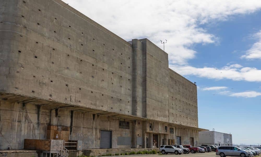
Adaptive reuse means taking a property that already exists and giving it a new job. An old warehouse becomes offices. A worn shopping center turns into housing and shops. A vacant office building shifts to a use the area needs more. The building stays. The use changes.
An ALTA survey helps a project team get ready for that shift. It gives them a clear, measured picture of what the property actually looks like today, before any reuse plan is set. That picture covers the property’s boundaries, existing structures and paving, as well as the recorded rights tied to the land.
California has reason to care about this right now. The state has looked at underused property it owns and wants to make it easier to identify and move toward commercial redevelopment. That effort puts more existing sites in front of developers who want to repurpose them, and each one needs a solid starting picture before the team decides what it can become.
Start With What the Property Already Is
A reuse project can’t really begin until the team knows the site as it stands. The building is there. The parking is there. The property lines are set. A reuse plan has to work with all of it, so the first step is getting those existing conditions down correctly.
An ALTA survey maps how the property’s boundaries line up with what’s built on the ground. It shows where the building sits inside the lot lines, where paving and drives run and how close improvements come to the edges of the property. On a developed site, that relationship matters, because the structures were placed years ago and may not match what current records suggest.
With that in hand, architects and developers have a dependable base to work from. They can look at a proposed new use knowing where the real walls, edges and boundaries are. Early planning stays grounded in the actual site instead of old assumptions.
Match Existing Improvements to the New Plan
Most adaptive reuse projects inherit a lot from the last use. A new plan has to account for all of it. Some of it stays, some gets reworked and some gets removed. What’s usually already on a developed site includes:
- The existing building and its footprint
- Parking areas and drive aisles
- Loading zones or service areas
- Site walls, fences and retaining features
- Signs, light poles and paved surfaces
An ALTA survey lets the team hold these surveyed conditions up against an early redevelopment concept. Say the plan calls for a courtyard where the parking sits, or a new entrance along one side. The survey shows whether the existing improvements really sit where the concept assumes. Sometimes a building footprint runs a few feet off from what everyone pictured. Sometimes paving crosses closer to a boundary than expected.
Those checks shape real decisions. When the existing layout doesn’t match the concept, the team finds out early, while the plan is still easy to change. Catching a mismatch on paper costs far less than finding it after demolition or construction starts.
Site Conditions That Can Shape the Redesign
Existing sites come with strings attached. Easements, rights of way and access points were often set up for the property’s old use, and they don’t disappear when the use changes. A reuse plan has to fit around them, or work through them.
This matters more during reuse than during steady operation. When a property keeps doing the same thing, those conditions sit quietly in the background. When the use changes, they can get in the way fast. A recorded easement might cross the exact spot where a new drive needs to go. An access point that worked for a warehouse might not fit a retail layout.
An ALTA survey brings these physical and recorded conditions into view so the team can plan around them. The survey has clear limits, though. It shows the land, the improvements and the recorded matters that can be drawn on a map. It does not decide zoning questions, building-code issues, environmental matters or legal rights. Those need their own review from the right professionals. The survey gives the team a factual base, and the judgment calls come after, from people trained to make them.
Better Information for California Redevelopment
California’s interest in reactivating underused state-owned property raises the value of good site information. When the goal is to move a site toward commercial redevelopment, the team needs a reliable read on what they’re working with before they commit to a concept.
A consistent property survey gives everyone on the team the same factual base. The developer, the architect, the engineers and the title professionals all work from one accurate picture of the site. That shared starting point helps the team weigh a reuse idea against real conditions rather than each person working from different information.
The survey sits alongside other reviews, not in place of them. Title review looks at ownership and recorded rights. Architects study whether the building can hold the new use. Engineers look at systems and structure. Environmental checks cover their own ground. An ALTA survey is one input among these. It gives the team measured site facts to work with.
A survey doesn’t get a project approved, and California doesn’t automatically require an ALTA survey for these efforts. Any requirement depends on the project, the parties involved and what a lender or public agency asks for. The survey helps a team make better-informed decisions. It won’t stand in for a permit, an approval or a promise that the reuse will work.
Fit the Survey Into the Project Early
The most useful time for an ALTA survey is early, while the team is still shaping the plan. A survey that arrives after decisions are made only records what happened. One that comes in during planning can actually steer those decisions. That’s the difference between a document and a working tool.
Getting the timing right takes coordination. The owner or developer, the surveyor, the title company, the architects and the engineers all have a stake in what the survey shows. When they talk early, the surveyor understands what the reuse plan needs, and the rest of the team knows what to expect back.
The intended new use also helps the team decide what the survey should cover. An ALTA survey has a set of standard requirements, plus optional items a client can request, often called Table A items. A project turning a building into housing may care about different site details than one turning a site into mixed retail. Talking through the reuse goal early helps the team pick a survey scope that fits, so the finished survey answers the questions the project will actually raise.
Frequently Asked Questions
Is an ALTA survey useful when an existing commercial building is being converted to a new use?
Yes. It gives the project team a measured look at the property and its site conditions while they work out whether a new use fits. Knowing where the boundaries, buildings and recorded rights sit helps the team plan the conversion around real conditions.
Can an ALTA survey determine whether a property is suitable for adaptive reuse?
No. A survey provides solid site and boundary information, but suitability rests on more than that. Zoning, building rules, the structure’s condition, environmental factors, financing and the proposed use all play a part. The survey is one input the team weighs next to those other reviews.
When should an ALTA survey be ordered for an adaptive reuse project?
Early, during the planning and due-diligence stage. Ordering it before major redevelopment choices are locked in means the site information is ready when the team needs it. A survey that comes in late can only confirm decisions instead of helping shape them.
