
How an ALTA Survey Supports Brownfield Redevelopment
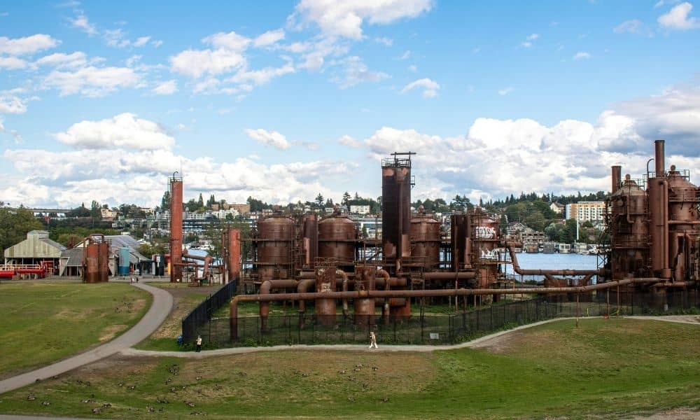
A brownfield site rarely starts with a clean slate. Past owners built on the land, paved it over and changed it. Before anyone plans a new use, the team needs a clear picture of what sits on the ground today. That’s where an ALTA survey earns its place.
Establishing the Property Framework Before Redevelopment Begins
A property that’s been in use for decades carries a tangled history. Old buildings, added fences, shifted access points and past construction all leave marks. Some of that history shows up on the ground. Some of it lives only in old records that may not match what you see now.
An ALTA survey gives the team a current, measured picture of the property. It shows the boundary, the improvements and the physical features as they stand today. This matters because a redevelopment plan often starts from site data the owner already has, and that older data can be incomplete or out of date.
When a project moves from early study into real redevelopment, guesswork gets expensive. Knowing the exact parcel in play keeps everyone honest about what land the team is working with. A measured survey sets that baseline before design choices lock in.
Connecting Existing Conditions With the Redevelopment Plan
An ALTA survey records what already exists on the site. That includes buildings, parking, paved areas and other features you can see. It also captures the physical features tied to access, such as drives and curb cuts. These details shape how a property can be reused.
The survey gives the owner, developer, architect and engineer one shared depiction of the site. Instead of each professional working from a different sketch, they all point to the same drawing. That common base cuts down on confusion later.
An ALTA survey documents physical conditions. It doesn’t test soil, water or buildings for pollution. Environmental consultants handle contamination questions and decide what cleanup a site needs. The survey and the environmental work run side by side, and they answer different questions.
Giving Design Teams a Reliable Starting Point for Site Reuse
Brownfield work usually means reworking an existing property, not building on open land. The design team has to fit a new idea onto a site that already has structures, grades and paving. Accurate property information helps them judge how well a plan fits.
Say a team wants to turn an old plant into a warehouse, a distribution hub, an office or a mixed-use space. Each of those uses places different demands on the site. Reliable survey data lets the designers test those ideas against real conditions early, before drawings go far.
The survey works next to other technical studies rather than replacing them. Civil, environmental, geotechnical and architectural teams each add their own piece. An ALTA survey supplies the property picture the rest of the work builds on.
Connecticut offers a live example of this kind of activity. The state has been putting money into former industrial and commercial sites so they can carry new uses. On June 17, 2026, Connecticut announced a round of brownfield funding for a set of blighted properties. The money supports investigation and cleanup work, along with planning, demolition and redevelopment. Projects like these move through many stages, and solid property data helps at the start.
Supporting Coordination When a Former Industrial Site Changes Use
Repositioning an old site brings a lot of people to the table. When an industrial, commercial or institutional property shifts to a very different use, the team grows fast. A shared survey base helps all of them read the property the same way.
Redevelopment decisions often rest on several separate studies. There may be an environmental review, a geotechnical report, a traffic look and more. An ALTA survey is one part of that larger record. It holds the measured property facts the other studies point back to.
It helps to keep roles straight. The survey doesn’t decide environmental questions. Findings about contamination and choices about cleanup come from environmental professionals and the review processes that govern them. The survey stays in its lane, and that clarity keeps the project on firm ground.
Using the Survey as Redevelopment Moves Toward Implementation
A good survey keeps working after the planning stage ends. As a project shifts from study into design and construction, the team keeps checking new work against what already sits on the site. Current survey data makes those checks reliable.
Timing and scope deserve attention early. The team should decide how the survey will be used and what it needs to cover before ordering it. A survey meant for a quick look may fall short once design begins. Setting the intended use up front avoids a redo.
An ALTA survey won’t fix a brownfield’s environmental problems. It can’t clean soil or remove risk. What it does is give the redevelopment team dependable property information so everyone works from the same starting point. In Connecticut, where plenty of older sites are moving toward new uses, that kind of steady baseline helps a project stay grounded, even though the state doesn’t require an ALTA survey for every brownfield.
Frequently Asked Questions
Can an ALTA survey identify environmental contamination?
No. This kind of survey records measured property facts and visible site conditions within its defined scope. Testing for pollution falls outside that work. Environmental consultants and other qualified specialists run those investigations and report what they find.
Why would a brownfield redevelopment team need an ALTA survey?
The survey gives the team a current, measured account of the property. With that in hand, they understand the existing site and can line up the planning and design work that follows. It acts as a shared reference the whole group can trust.
Does an ALTA survey replace a Phase I Environmental Site Assessment?
No. They cover different ground. A Phase I Environmental Site Assessment looks at environmental conditions and flags possible concerns tied to past use. An ALTA survey reports surveyed property information under the ALTA/NSPS standards. A brownfield project usually needs both.
