So, you might ask – “What is an ALTA Survey?” When it comes to land surveys, an Alta Survey is a specialized type that provides a comprehensive analysis of a commercial property’s boundaries, improvements, and potential risks. In this guide, we’ll break down everything you need to know about Alta Surveys, from their purpose to the information they typically include.
What is an Alta Survey?
In simple terms, an Alta Survey is a detailed land survey that satisfies the minimum requirements of the American Land Title Association (ALTA) and the National Society of Professional Surveyors. It provides highly accurate information about the boundaries, easements, improvements, and potential risks associated with a property. The purpose of an Alta Survey is to assist in commercial real estate transactions by ensuring that buyers have full knowledge of what they are purchasing and any title issues that may exist. This type of survey is typically conducted by licensed surveyors with expertise in evaluating properties for commercial transactions.
The importance of an Alta Survey
An Alta Survey is a necessary and valuable tool for commercial real estate transactions. It ensures that buyers and lenders have all the information they need to evaluate a property before making any transactions. This survey can reveal potential risks associated with the property, including easements or encroachments, that could affect the buyer's use of the land or limit its value. Without an Alta Survey, buyers could be purchasing a property with unknown liabilities or limitations. The cost of conducting this survey may seem high, but it is much less expensive than discovering issues after closing and having to deal with them later on. Therefore, an Alta Survey is essential for protecting both buyers and sellers in commercial real estate transactions.

Key Elements of an Alta Survey
An Alta Survey is a comprehensive land survey that provides detailed information about a property beyond what a typical boundary survey would show. The survey includes information on property boundaries, improvements, easements, encroachments, and other features that could impact the property’s use or value. It also includes information on zoning regulations, flood zones, and topographic features of the land. All of this information is compiled into a report that can be used by buyers and lenders to make informed decisions about the property. Understanding the key elements of an Alta Survey can help ensure that you’re getting the most accurate and relevant information about a property before you make any transactions.
The process of Obtaining an Alta survey
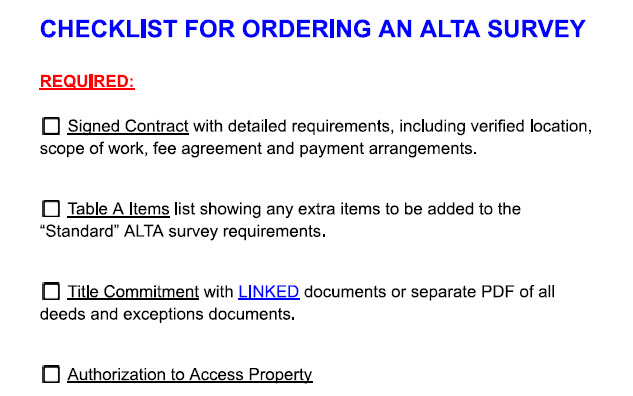
Obtaining an Alta Survey involves a few essential steps. To begin, you need to hire a professional, licensed surveyor who specializes in Alta Surveys. The surveyor will then visit the property and conduct a physical inspection of the land and any improvements on it. This includes measuring the boundaries of the property and identifying any encroachments or easements that could impact its use. Next, the surveyor will perform extensive research, including reviewing maps and records from local government agencies, to gather information on zoning regulations, flood zones, and other relevant details about the property. Finally, all of this information is compiled into an Alta Survey report that can be used by buyers and lenders to make informed decisions when purchasing or financing a property. It’s important to note that obtaining an Alta Survey can take several weeks or even months to complete depending on the complexity of the property being surveyed.
Cost and time associated with getting an Alta survey done

An Alta Survey is a comprehensive and detailed land survey that covers the physical and legal aspects of a property. As such, it requires significant time and resources to conduct properly. The cost of an Alta Survey varies depending on various factors such as the size of the land, its location, and the complexity of the survey. Typically, larger properties with more improvements will cost more than smaller ones. It’s essential to note that obtaining an Alta Survey can take several weeks or even months to complete. This timeline can be affected by multiple factors including access restrictions, inclement weather conditions, or any issues discovered during the research phase that need additional investigation or resolution before completing the report. Despite these costs and time constraints, obtaining an Alta Survey is essential for anyone who wants an accurate picture of their land’s boundaries and potential use limitations.

